Sorogain

Ruta Megalítica

(Megalithic Route)

This route lets you explore Sorogain as a landscape built up over thousands of years.

About the route

Megalithic monuments are its oldest traces, but not the only ones. The pastures maintained over generations by herders, the Marcas of Sorogain and Urepel (traditional livestock-marking gatherings), the mountain passes and the paths towards Urepel show a striking continuity in the use of the mountain, with centuries and even millennia of shared and sustained use.

Farming and herding communities have traditionally taken a long-term view, mindful that the fruits of their work must also serve future generations. The route leaves the CIS, climbs through Sorogain towards Aztakarri, passes through Pilotasoro and returns via Beraskoain. Reading this landscape is not simply a matter of locating stones: it invites us to understand why certain places were chosen, walked and reused over generations. You will walk through pastures, passes and mountain crossings that have been frequented for millennia. Since the Neolithic, livestock farming has been one of the activities that has done most to shape this landscape. In the 1970s and 1980s, modernisation rapidly transformed many customs and land uses.

Distance
9 km

Duration
≈ 3h 30′ / ≈ 4h (with stops)

Elevation gain
256 m

Difficulty
Medium

 Listen to La Ruta Megalítica ( 🔊 )

Interpretive stops along the route

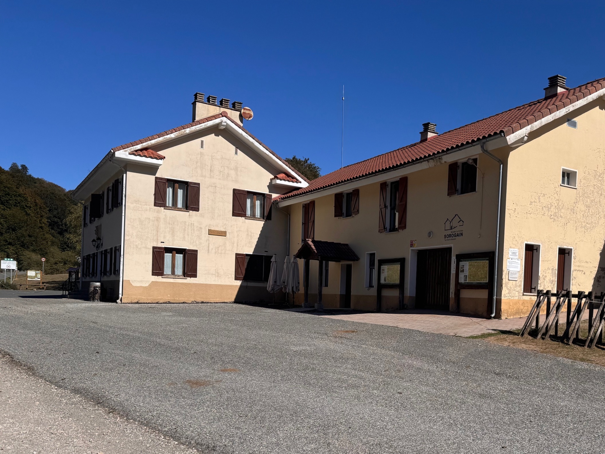
Centro de Interpretación de Sorogain y albergue. Fuente: Kaizen.
Point 0. CIS — Before setting out
Sorogain Interpretation Centre and hostel. Source: Kaizen.

Before setting out, visit the Sorogain Interpretation Centre. The CIS was conceived as the gateway to the Sorogain area and the starting point for its themed trails.

Its exhibition presents three key themes for reading and understanding Sorogain — Nature, Human Footprint and Border Territory — and links them to digital content available on the website. Its automated operation allows visitors to explore the Centre independently and then continue the experience outdoors.

The Centre is one of the actions under the Destination Tourism Sustainability Plan for the Navarrese Pyrenees, funded by NextGenerationEU.

Next to the CIS, the Sorogain Hostel offers accommodation, as well as bar and restaurant services.

Before setting off, download the GPX track: mobile coverage can be patchy in some parts of Sorogain. Wear suitable clothing and footwear for hiking, check the weather forecast before setting off, respect private property and livestock, keep your dog on a lead and always leave livestock gates as you find them. In an emergency, call 112.

On this route, we look for the oldest traces in the landscape and explore their relationship with the pastures, mountain passes and paths that still shape the mountain today.


⚲ View location on the map

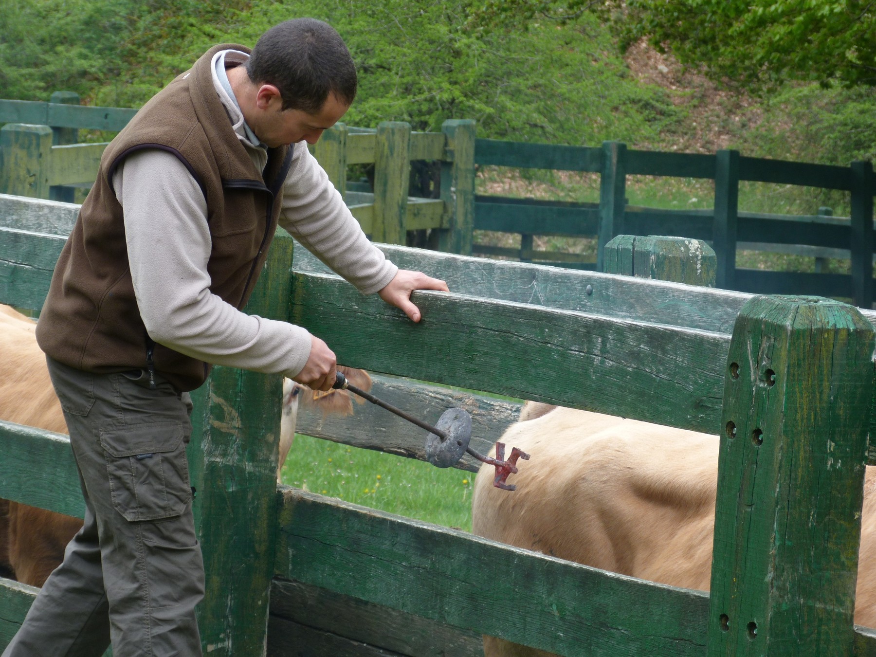
Marca de Sorogain. Momento del marcado del ganado. Fuente: Asociación Elutseder.
Marca de Sorogain. Livestock-marking event. Source: Asociación Elutseder.

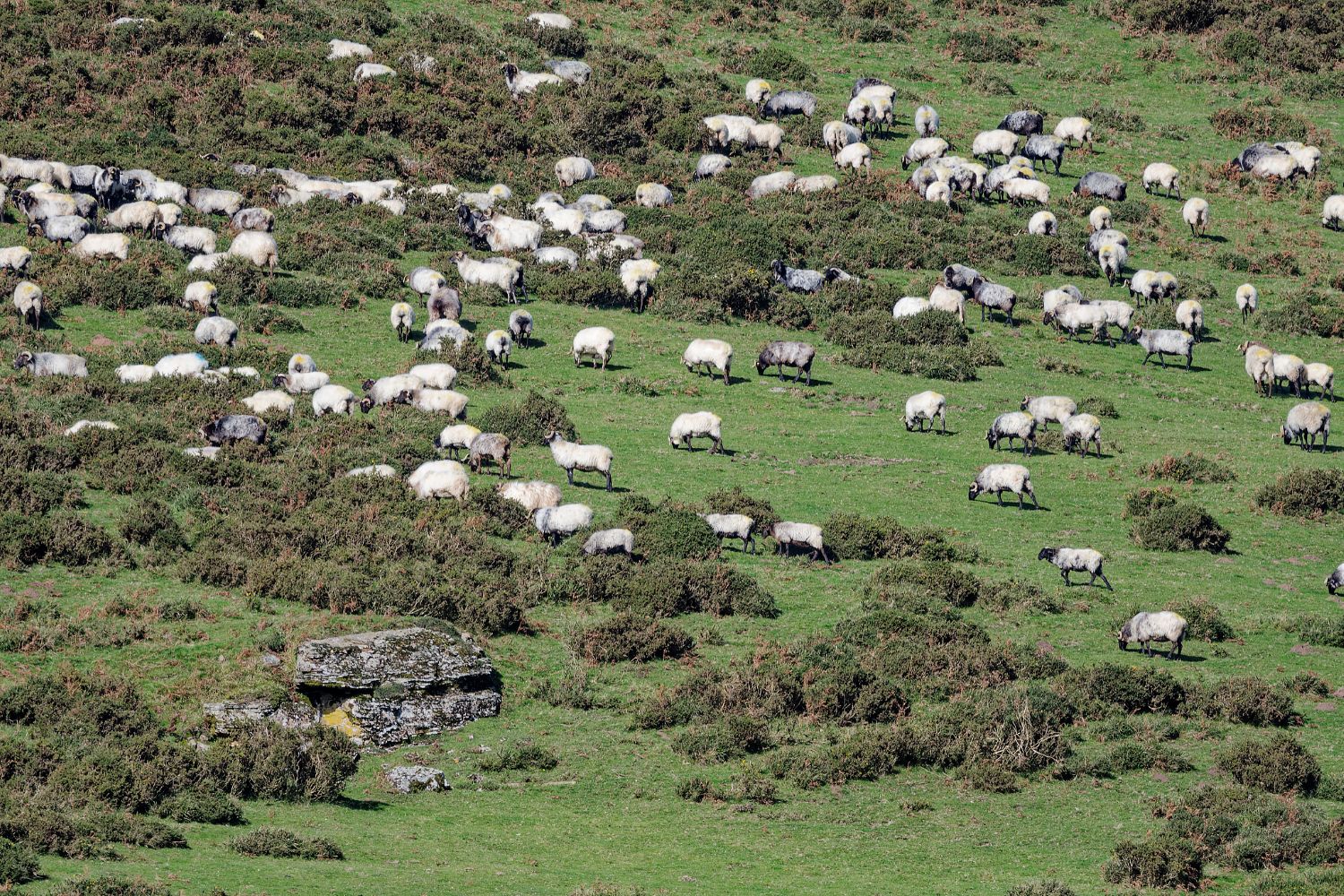
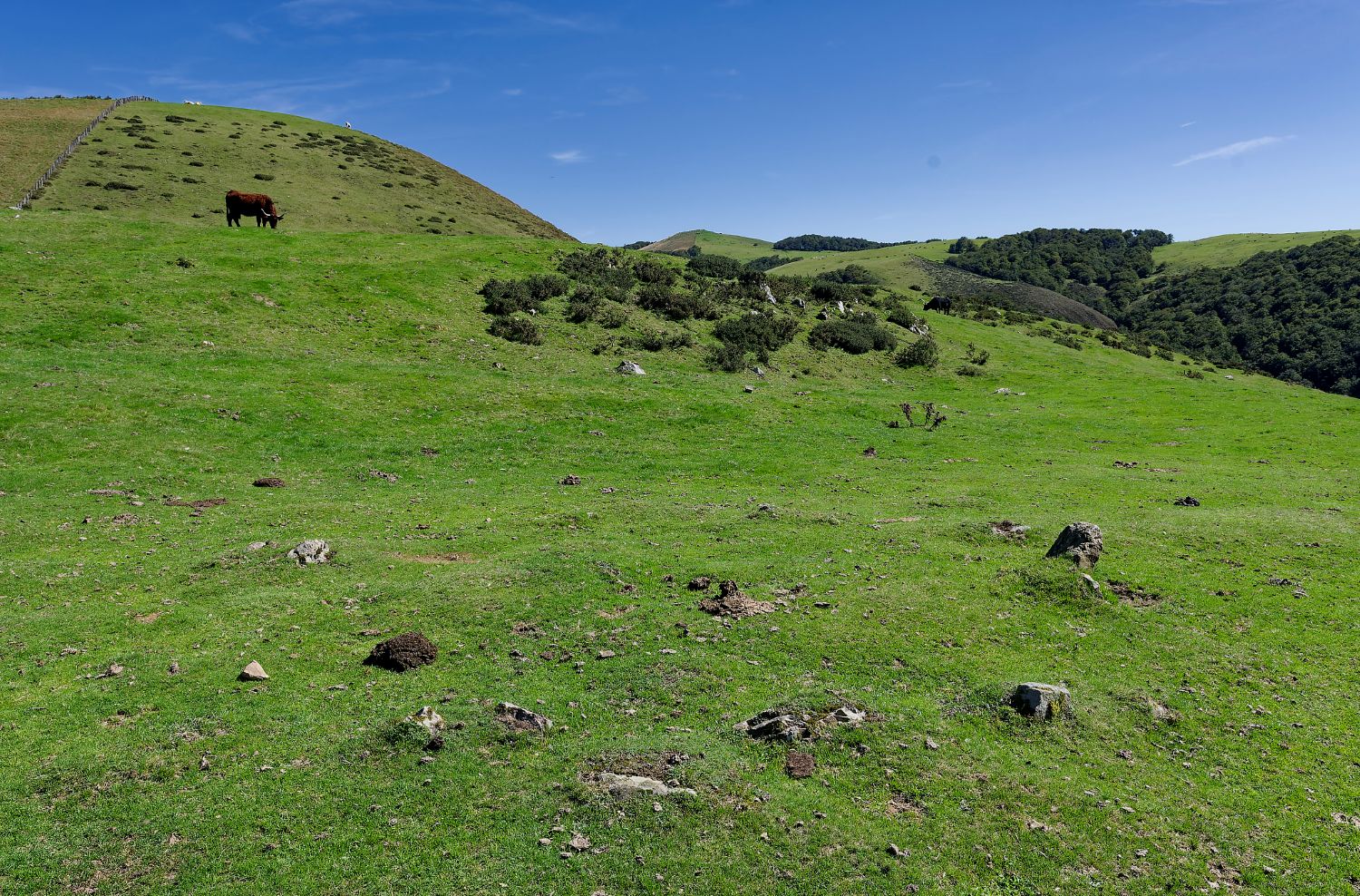
Sorogain’s large open spaces are not simply the result of climate or altitude. For generations, grazing has helped keep the forest in check and preserve the mountain pastures.

Among the livestock breeds most closely tied to the territory are the Burguete horse, Pirenaica cattle and the Latxa sheep. The Marcas of Sorogain and Urepel are two of the most visible expressions of this herding culture. At certain times of year they bring together livestock and the herders of Erroibar/Valle de Erro and the Baigorri Valley, and represent a long tradition of shared use of the pastures.

The image is especially powerful: the very landscape where prehistoric monuments stand is still walked and maintained by flocks thousands of years later, making visible a long continuity of herding culture.


⚲ View location on the map

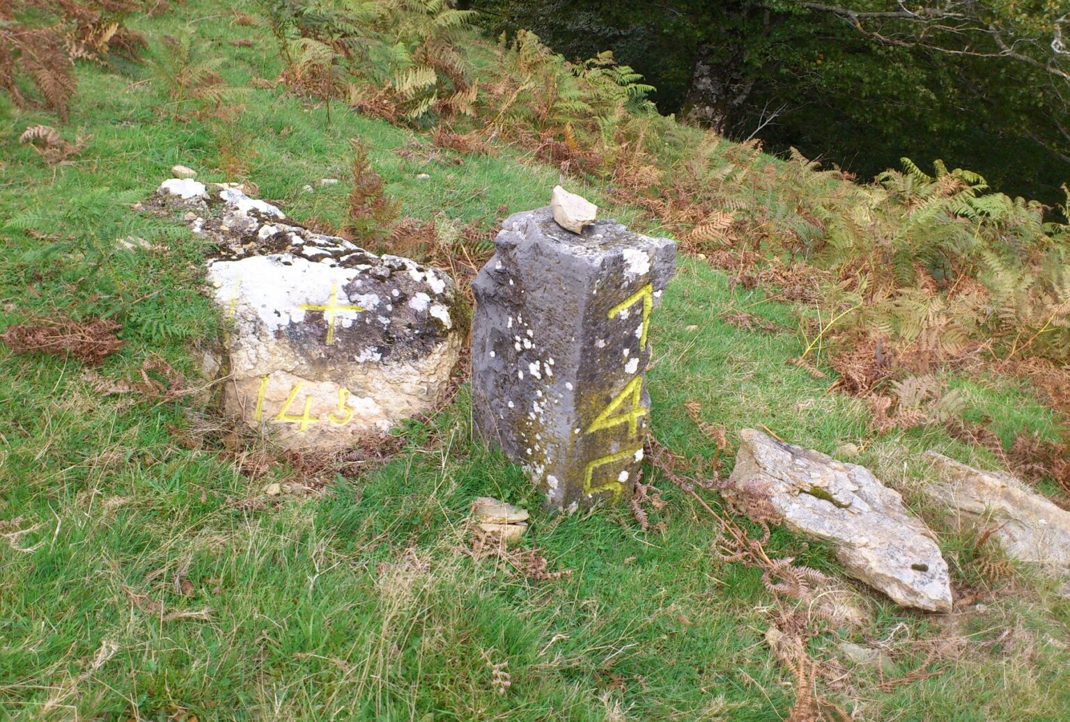
Muga fronteriza numerada. Fuente: Asociación Elutseder.

From the heights of Aztakarri, Sorogain’s position within a much larger historic territory becomes clearer: the Quinto Real, also known as Kintoa or Pays Quint.

For centuries, the valleys of Erroibar/Valle de Erro, Baztan and Baigorri had rights and interests — and also disputes — over these mountains, where forests and pastures were essential resources.

The 1856 Treaty of Limits set the current international border, and that line was marked on the ground with numbered boundary stones, or mugas. But a political border did not erase earlier relationships. Shared livestock use and agreements between Erroibar/Valle de Erro and Urepel are a reminder that, before being divided between states, this was a single territory bound together by paths, pastures and shared ways of life.


⚲ View location on the map

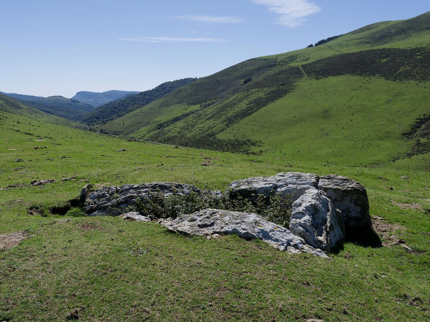
Dolmen de Pilotasoro. Fuente: Kaizen.
Dolmen de Pilotasoro. Source : Kaizen.

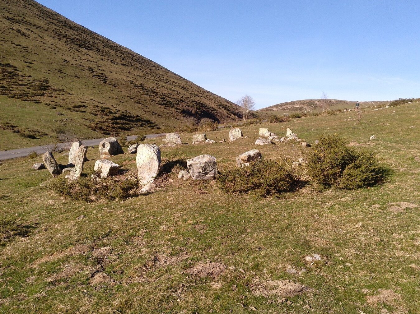
At around 1,000 metres above sea level, Pilotasoro is not an isolated monument. Here stands a dolmen identified by José Miguel de Barandiaran in 1948 and, just a few metres away, a cromlech; other tumuli also appear nearby.

There is no record of the dolmen having been excavated, so we do not know precisely when it was built, who was buried here or what objects might have accompanied them. What is significant is the site chosen: these monuments cluster in the high pastures, close to passes and natural routes

Thousands of years ago, this mountain landscape was already being walked, used and given meaning by the communities living in the Pyrenees. Much current archaeological scholarship considers that, besides being funerary monuments, some megaliths may also have served to mark territory and to reinforce community cohesion. It is worth dispelling the common notion that links them to hunter-gatherer societies: they are later, and belong to settled agro-pastoral communities that had reasons to mark and organise their territory.


⚲ View location on the map
FIND OUT MORE · Dolmen, cromlech and tumulus

These are not the same thing. A dolmen is a funerary structure made of large slabs, originally covered by a tumulus. It is the oldest type of megalith, along with the menhir or standing stone, and corresponds to the pastoral cultures of the Late Neolithic–Chalcolithic (3000–2200 BC). Bodies were buried inside. A cromlech is a stone circle associated in the Pyrenees with later funerary practices, from around 900 BC. Bodies were first cremated and the ashes buried in cists (small stone boxes, equivalent to our urns). A tumulus is an artificial mound of earth and stones that may contain or mark a funerary structure. Their presence together reveals a long symbolic use of these heights and the reuse of certain places across different cultures, through their own symbolic codes.

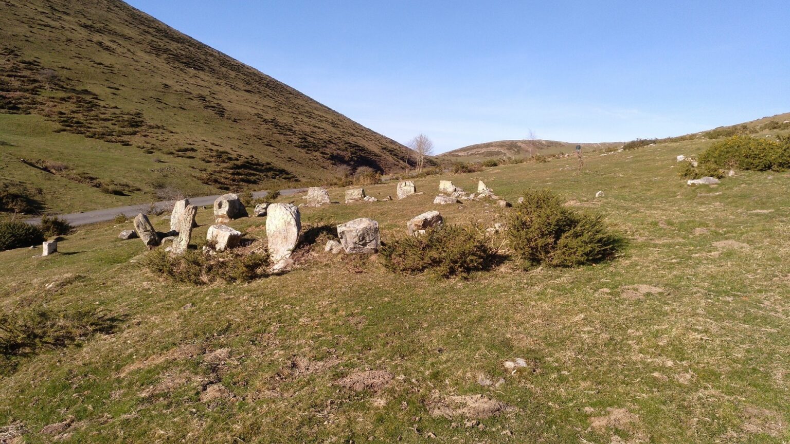
Crómlech de Beraskoain. Fuente: Kaizen.

At the Beraskoain pass, megalithic monuments reappear: several features have been recorded here, including dolmens and a cromlech, distributed around the pass. But there is another key to understanding Sorogain here: the path.

This corridor links Sorogain with Urepel and, over time, has been used by people who herded livestock, worked in the mountains or lived on both sides of the border and, more recently, by people involved in smuggling or by people on the run

We do not know whether those who raised the megaliths followed exactly the same path we walk today, but their position beside natural passage points reflects a constant: terrain shapes how people move. Stones change their meaning; paths endure.


⚲ View location on the map
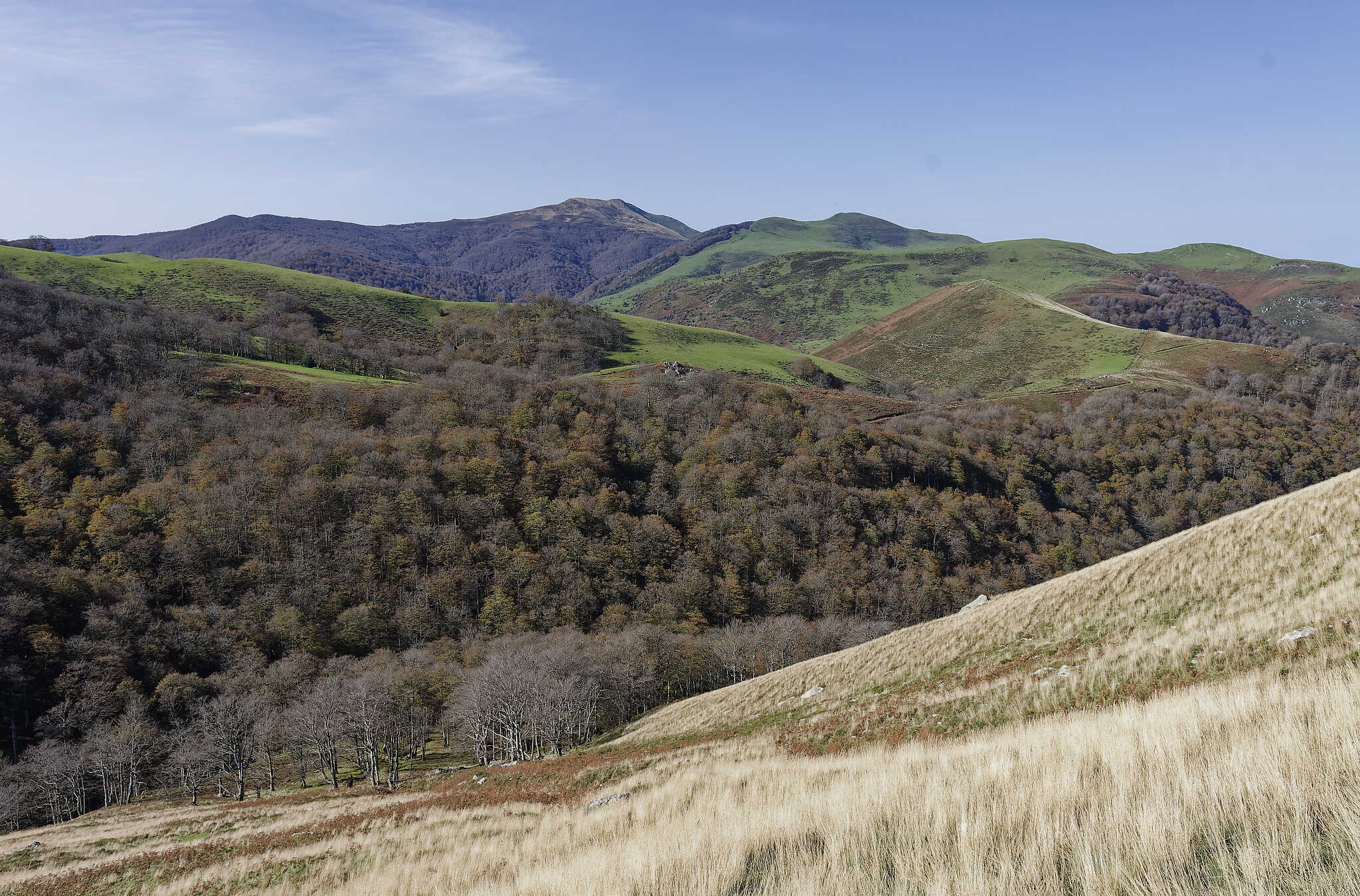
Pastizales de altura y caminos de Sorogain. Fuente: Kaizen.
High pastures and paths of Sorogain. Source: Kaizen.

From Beraskoain, the return leads back to the CIS. The route you have just walked has moved from prehistory to the pastoral landscape and the border, without ever leaving the same passes and natural corridors

This continuity is one of the central ideas of Sorogain Territorio Museo: each era adds new functions and stories to a space already used by earlier generations.

If you want to continue reading the territory through much more recent history, the Ruta del Contrabando y la Fuga de Ezkaba picks up other stories tied to these same paths. On returning to the Centre, the itinerary closes where it began: with an overall reading of Sorogain and of the successive layers that have shaped its landscape.


⚲ View location on the map
Map of the route

Download the Megalithic Route onto your device.

Visit the Centre

Plan your visit to the exhibition and discover the history, landscape, and memory of Sorogain.